- 244 Posts
- 33 Comments


 3·8 days ago
instead of a royalty free cinema-psychology-emotion-symphony track.
Here an good voice over with some cool observations etc… https://www.youtube.com/watch?v=IMd2A1Wljfc
I hope that we’ll get all that raw data soon
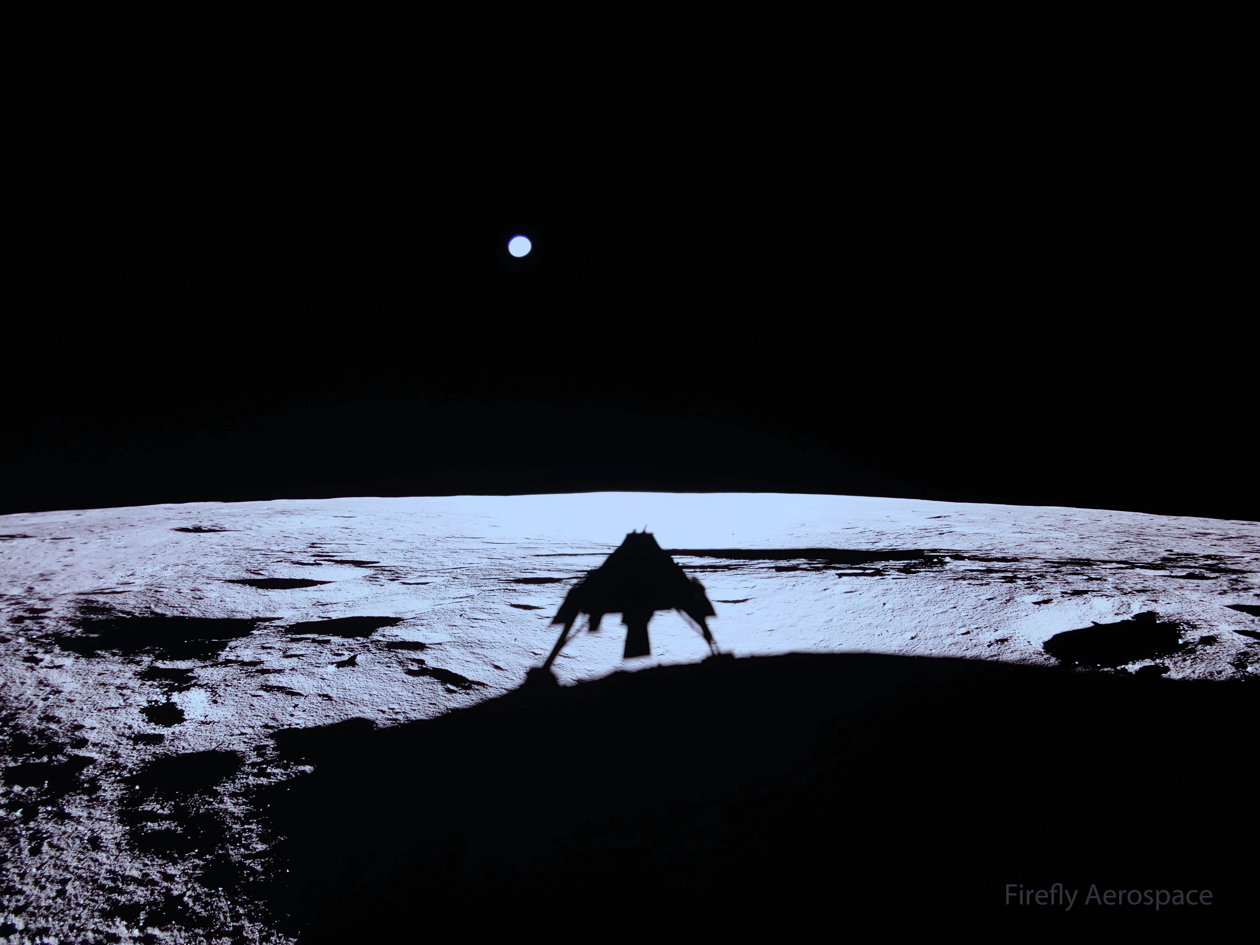
It would seem bigger, but this is imaged with a wide angle lens. The lander has a lot more cameras, I’m sure we’ll get some better shots of Earth and a nice panorama of the lander’s surroundings in the coming days It’s mission will only last 60 days, so they have a lot to do in a short time.
I really admired and miss that guy.


 3·16 days ago
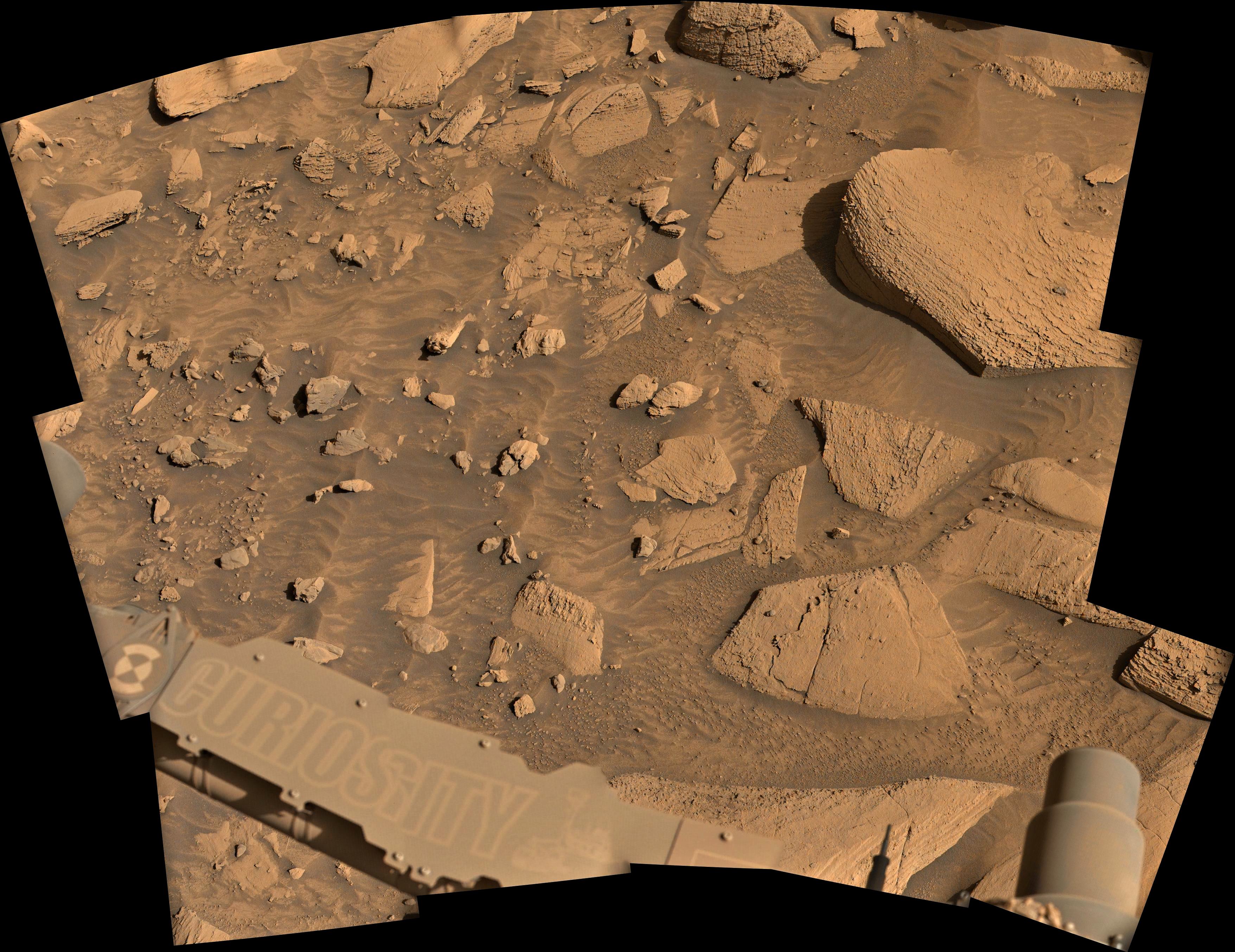
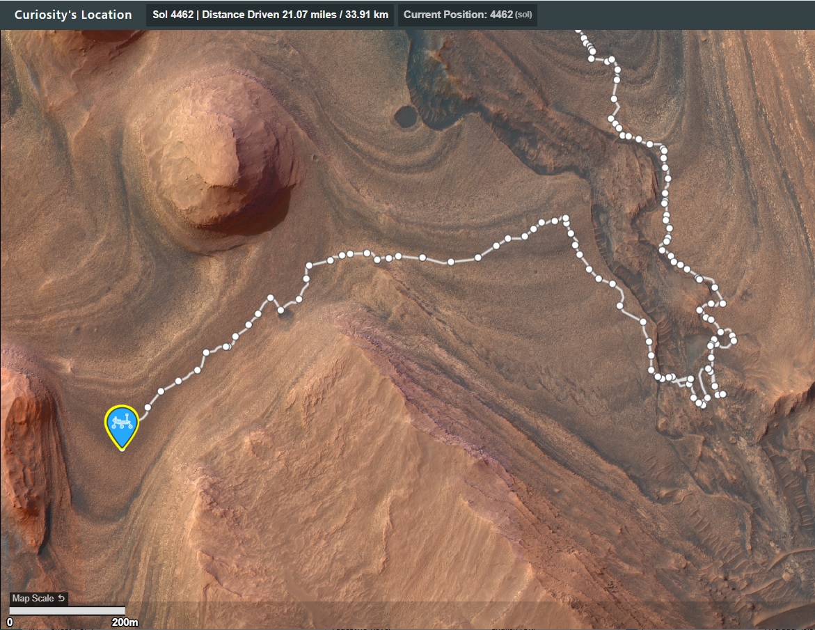
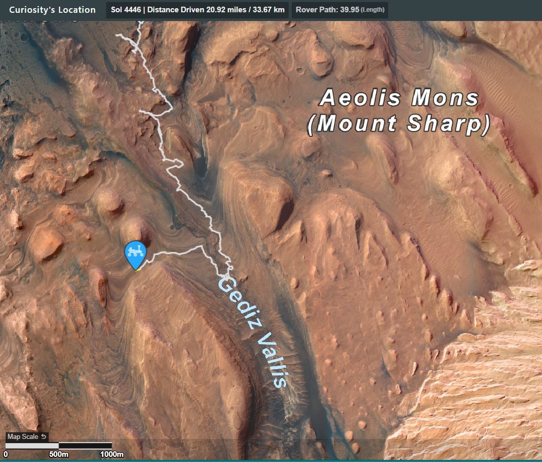
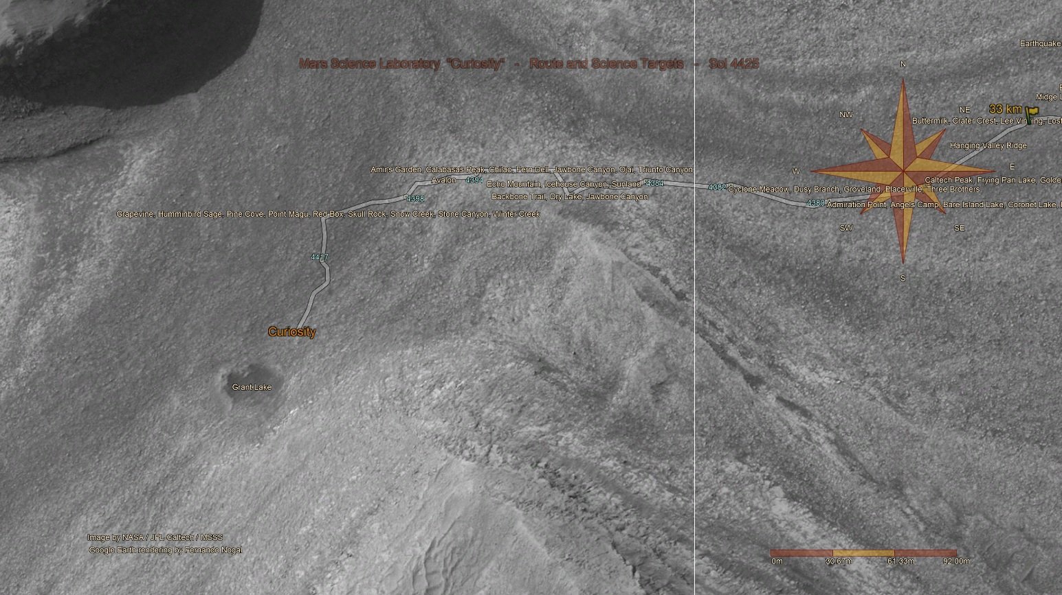
Screen capture of the updated traverse map shows the continuation of the drive to the SSW
NASA/JPL-Caltech/UofA
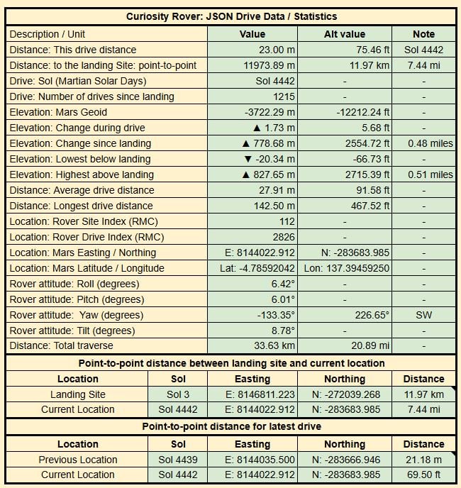
Detailed drive data from JPL’s JSON feed

This will eventually be a full 360 degree panorama
Earth planning date: Tuesday, Feb. 18, 2025
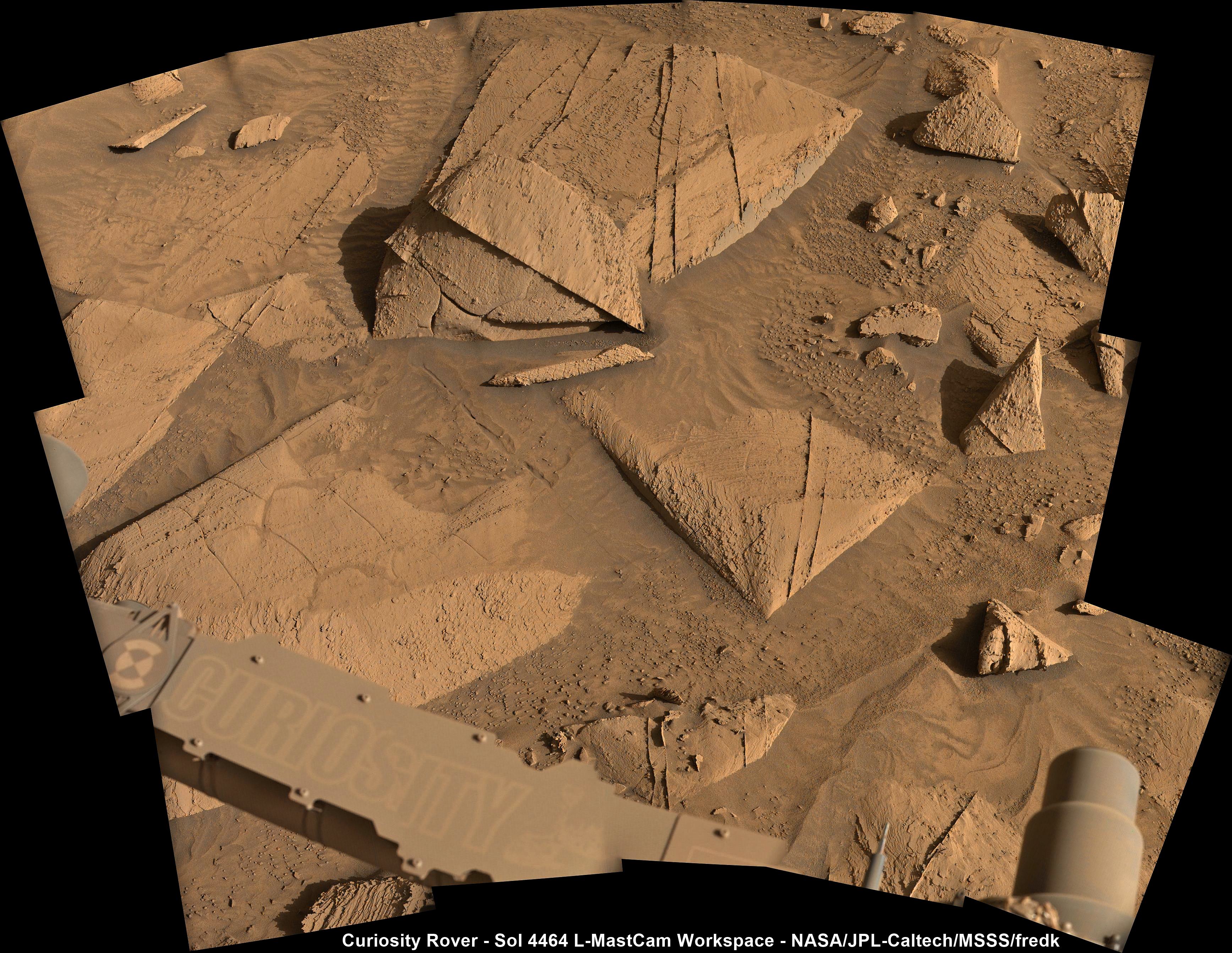
During today’s unusual-for-MSL Tuesday planning day (because of the U.S. holiday on Monday), we planned activities under new winter heating constraints. Operating Curiosity on Mars requires attention to a number of factors — power, data volume, terrain roughness, temperature — that affect rover operability and safety. Winter means more heating to warm up the gears and mechanisms within the rover and the instruments, but energy that goes to heating means less energy for science observations. Nevertheless, we (and Curiosity) were up to the task of balancing heating and science, and planned enough observations to warm the science team’s hearts.
We fit in DRT, APXS, and MAHLI on two different bedrock targets, “Chumash Trail” and “Wheeler Gorge,” which have different fracturing and layering features. In the workspace, ChemCam targeted a clean vertical exposure of layered bedrock at “Sierra Madre” and a lumpy-looking patch of resistant nodules at “Chiquito Basin.”
The topography of the local terrain and our end-of-drive position after the weekend fortuitously lined up to give us a view of an exposure of the Marker Band, which we first explored on the other side of Gediz Vallis Ridge. Having a view of another exposure of this distinctive horizon helps give us further insight into its origin, so we included both RMI and Mastcam mosaics of the exposure.
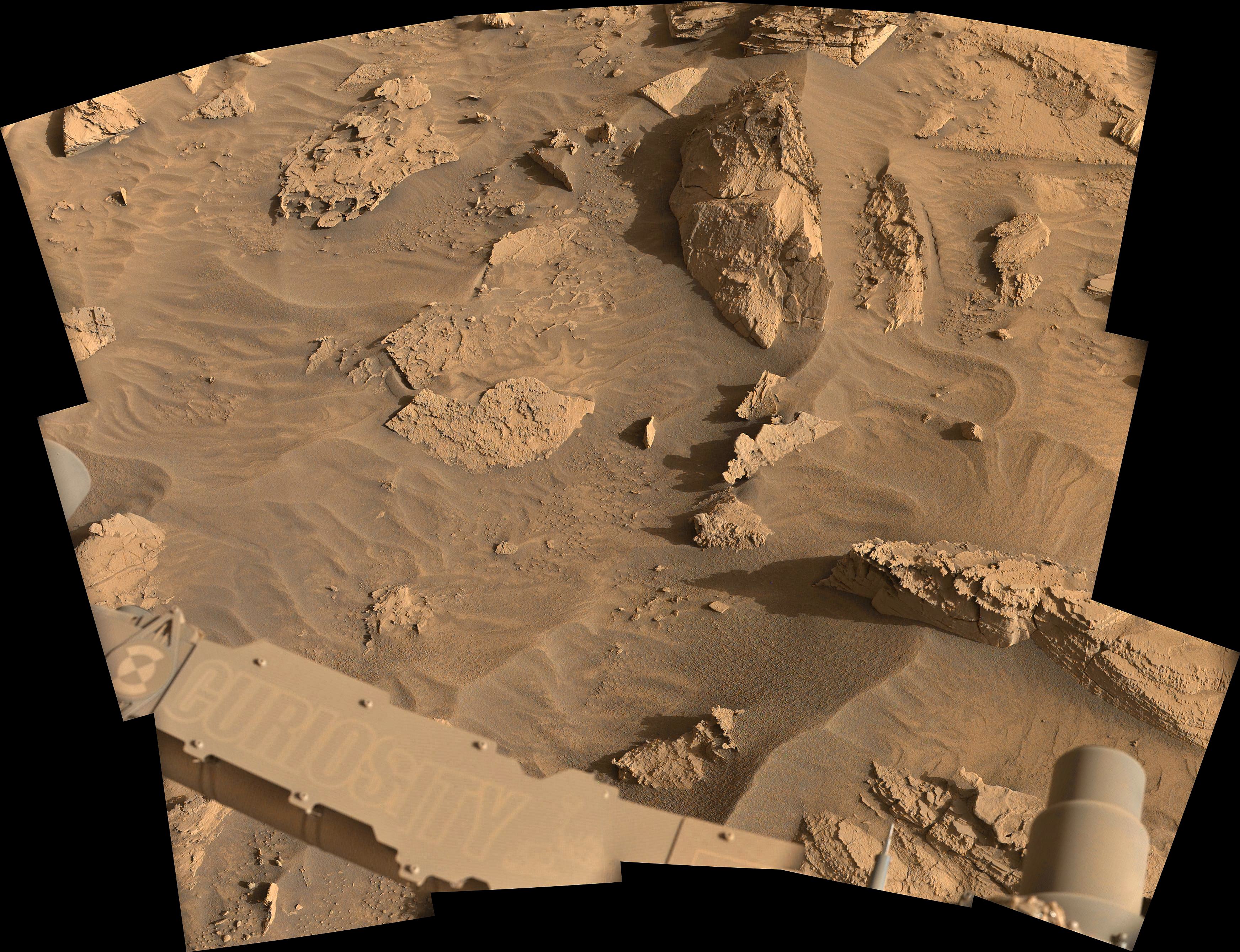
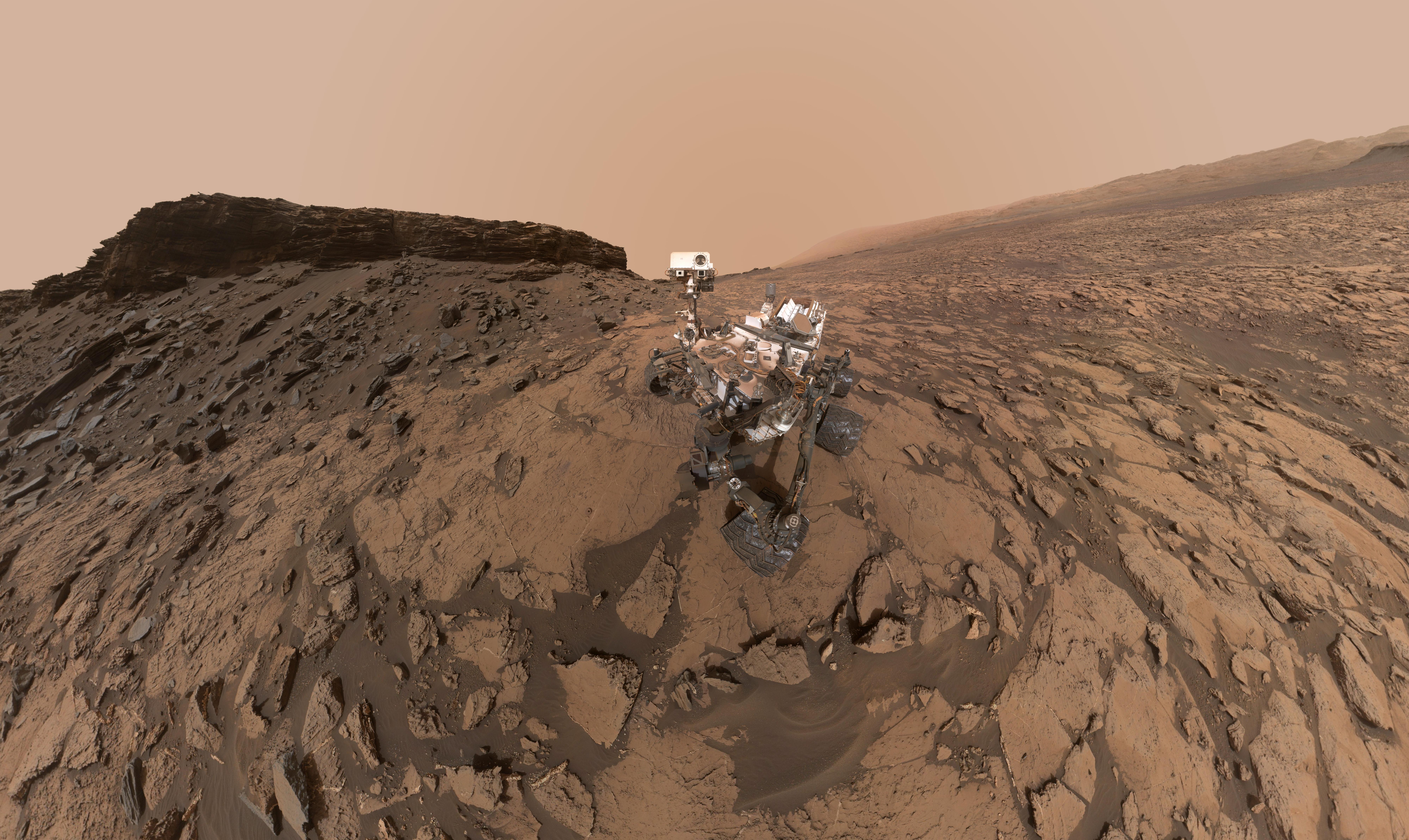
Documenting a feature that, unlike the Marker Band, has been and will be in our sights for a long time — “Texoli” butte (pictured above) — was the goal of additional Mastcam and ChemCam imaging. Observations of potential sedimentary structures on the flank of Texoli motivated acquisition of an RMI mosaic, and a chance to capture structures along its southeast face inspired a Mastcam mosaic. Good exposures of additional nearby bedrock structures at “Mount Lukens” and “Chantry Flat” drew the eye of Mastcam, while another small mosaic focused on the kind of linear troughs in the sand we often see bordering bedrock slabs. Environmental observations included Navcam cloud and dust-devil movies, Mastcam observations of dust in the atmosphere, and REMS and RAD measurements spread across the three sols of the plan.
Written by Michelle Minitti, Planetary Geologist at Framework
Image Info - NASA’s Mars rover Curiosity captured this image of the Texoli butte, a Martian landmark about 525 feet (160 meters) tall, with many layers that scientists are studying to learn more about the formation of this region of the Red Planet. The butte is on the 3-mile-high Mount Sharp, inside Gale Crater, where Curiosity landed and has been exploring since 2012. The rover acquired this image using its Left Navigation Camera on sol 4456, or Martian day 4,456 of the Mars Science Laboratory mission, on Feb. 17, 2025, at 17:51:56 UTC. NASA/JPL-Caltech
Crazy how hires this image is, given how far away it came from
The rover is currently 113 million kilometers from Earth, with a round trip light time of 12.58 minutes… So yes, the image came a long way, but it’s a mosaic of 15 images, so the resolution is a little higher that we would get from a single image :)
A wider view of the traverse (1km scale bar)
Drive data
Ooops…
I’ll repost it in M20 😱
Annotated screen capture of the ESA mission map (with scale bar)
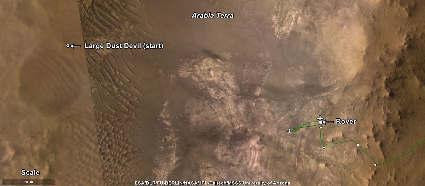
Updated map, shared by Fernando Nogal and posted on the UMSF After Party discord channel
Data for the drive on sol 4425.
The raw data in this table is provided by JPL shortly after each drive. Credits: NASA/JPL-Caltech
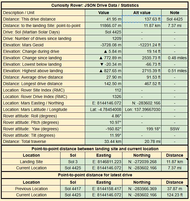
My bad, the drive happened 7 sols earlier on sol 4417, but a new set of post drive images were acquired on 4423.
Quela
Here’s a link to the standard panorama (PIA20844) as produced by JPL: https://photojournal.jpl.nasa.gov/jpeg/PIA20844.jpg
This self-portrait of NASA’s Curiosity Mars rover shows the vehicle at the “Quela” drilling location in the “Murray Buttes” area on lower Mount Sharp.
Key features on the skyline of this panorama are the dark mesa called “M12” to the left of the rover’s mast and pale, upper Mount Sharp to the right of the mast. The top of M12 stands about 23 feet (7 meters) above the base of the sloping piles of rocks just behind Curiosity.
The scene combines approximately 60 images taken by the Mars Hand Lens Imager (MAHLI) camera at the end of the rover’s robotic arm. Most of the component images were taken on Sept. 17, 2016, during the 1,463rd Martian day, or sol, of Curiosity’s work on Mars. Two component images of the drill-hole area in front of the rover were taken on Sol 1466 (Sept. 20) to show the hole created by collecting a drilled sample at Quela on Sol 1464 (Sept. 18).
The skyline sweeps from west on the left to south-southwest on the right, with the rover’s mast at northeast. The rover’s location when it recorded this scene was where it ended a drive on Sol 1455
The view does not include the rover’s arm nor the MAHLI camera itself, except in the miniature scene reflected upside down in the parabolic mirror at the top of the mast. That mirror is part of Curiosity’s Chemistry and Camera (ChemCam) instrument. MAHLI appears in the center of the mirror.
Wrist motions and turret rotations on the arm allowed MAHLI to acquire the mosaic’s component images. The arm was positioned out of the shot in the images, or portions of images, that were used in this mosaic.
For scale, the rover’s wheels are 20 inches (50 centimeters) in diameter and about 16 inches (40 centimeters) wide.
Image Credit: NASA/JPL-Caltech/MSSS
I’ll share other 360Cities as I find them, I know there’s a few out there :)
3rd times a charm?