
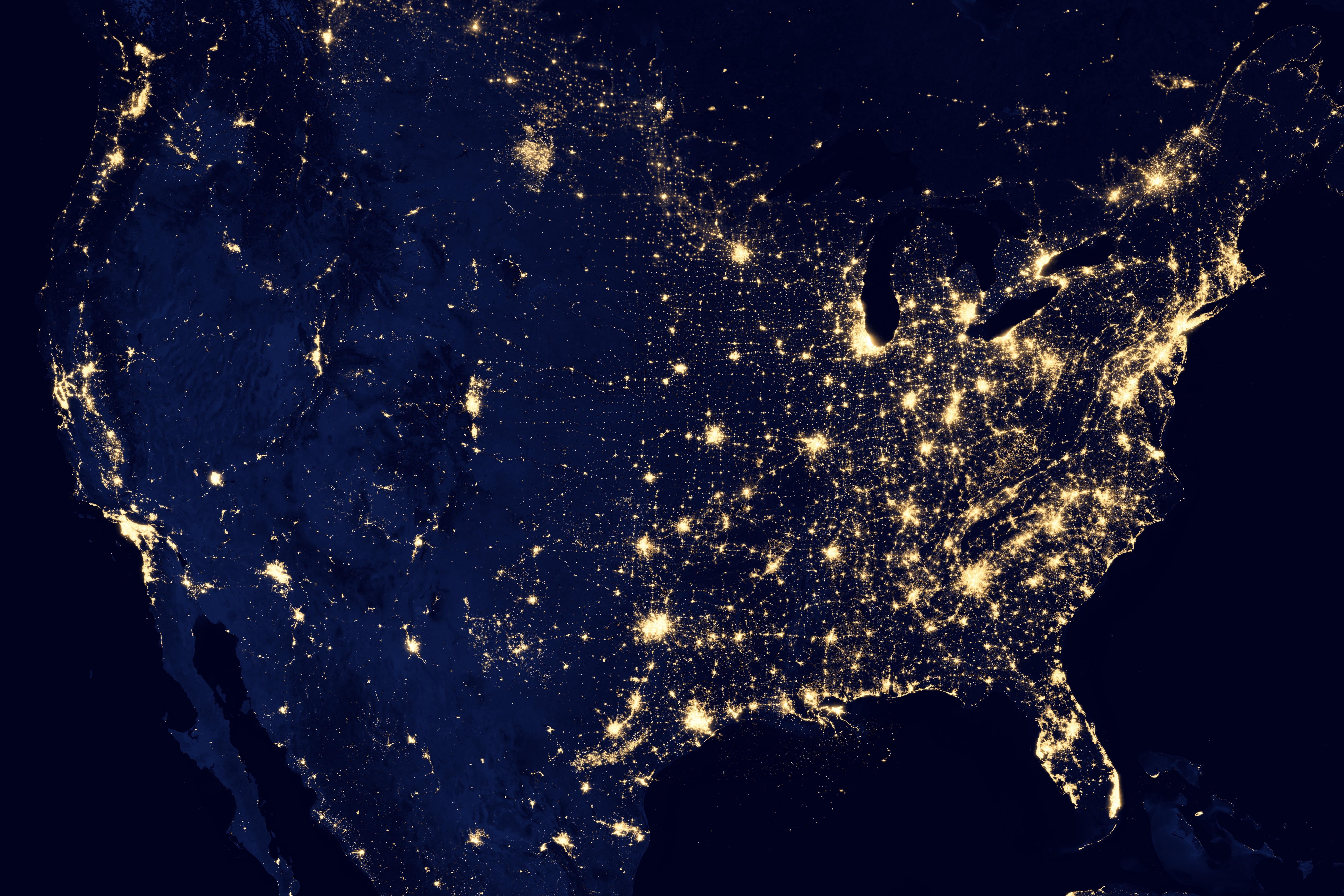
It’s a light pollution map!
Satellite image at night.
I named it Gerald.
To me it looks more like a Bertha.
The community is called No Stupid Questions but apparently it does have stupid answers.
Okay in all seriousness, this kind of comment is not helping the asker at all.
Maybe not, but it apparently helped mildly amuse significantly more folks than it pissed off so I’m happy with it.
idk, a light map? you trying to Google it? or just for the trivia knowledge?
satellite map.
Where’s Waldo?
Nighttime satellite light map?
Thanks
Crazy how sparsely populated the US is west of Dallas, TX.
It’s mostly desert and mountains
The east / west division in the cost of light bulbs.
!solved
Unsolved?
Uhhh… A picture?
Looks like a jpeg to me
Baaabbbaaaa yeettuuuu yeettuuuu leeeyyaaaiiie… 🎶
JPEG
and i like JPEGS
If you’re talking data viz, maybe a dichromatic chloropleth geo chart or a hot spot/density map?
Yeah heat map seems to be the most generic term for it.


